
This, as most of these pages, is temporary.
Diving in Mull is quite legendary. People flock from all over to dive there, and it's well worth the journey. But what about the poor souls who have to organise the logistics of an expedition up there, rather than settle for the over-priced, inflexibility and limitations of a charter boat (especially those black and yellow ones).
I have put together the following pages as a resource for anyone interested in organising diving at the common sites around Mull. This is an accumulation of information gathered from first hand experience mainly-to save you the effort of having to sift each site one by one. Each wreck/site is described briefly, along with the logistical considerations and, where possible, i have put a link to a more detailed description of the site.
I don't claim to be an expert on these sites, I've just been lucky enough to dive there a few times. Let me know if there's anything here you'd like to see corrected. Also, email me or consult other sources for clarification on any details here.
Map of Mull (it's a bit rough but I've got better things to do with my time than draw maps!)
1) Tobermory Harbour (fee due): recently refurbished facilities, still a very steep slip which is, I think, always usable. A fee is payable to the Harbourmaster, 07810375453, and includes freshwater and the use of pontoons/mooring. Ample parking for cars and boats. Handy bar and compressor at one side of car park. Only a left handed run which may be usable.
2) Salen Moorings, Mull (private): not a slip as such, but a cleared path through the rocks/kelp. Drive north through Salen towards tobermory. ˝ a mile down the road you'll see the moorings. Not for the faint hearted. 'Usable' at all states of tide but care needed. No run for vehicles, parking very, very limited and this is a private area. Ask for permission first as this belongs to the Salen Moorings Association. The only contact I have is: 01631770369, otherwise try the Police station, sign posted in Salen.
3) Loch Aline (ferry, free): Use the ferry slipway. It goes without saying that you have to be aware of where the fishnish – loch aline ferry is, it is regular and they won't be happy if you're faffing on the slip way. As soon as it's launched, move your boat to the smaller slip next to the pier. I remember recovering the boat here with the engine locked down!! Toilets, ok parking and excellent food from Jean's trailer. Dive centre is up the hill, past the post office-a bit of a hike if you're carrying bottles. Slip has a long run.
4) Craignure (free): Drive south past the ferry terminal (about 500m) and it's on your left-there's a big breakwater. This is a steep slip but with a long run at the top. Not usable at low water, algae covered at mid-water. Vehicle and rope very useful! There is a campsite next to the slip which, if you ask the owners nicely and promise NOT to use vehicles on the beach (i.e you have a small boat), can be used. Plenty of parking space, and the village hall toilets are usually able to be used.
5) Carsaig (free): this is NOT a slip, nor a cleared path. It is a very bouldery beach next to a disused pier, over which, if you're determined, you can carry a boat. These is definitely not for the faint hearted, or RIB owners. Even the road there takes some guts and you have to ensure you have a good towing vehicle. We managed to launch and recover our 5.25m inflatable with 40hp engine over here, with 8 people. The nearest slip is about 10 miles away, further west. Parking is very limited and you have to use your imagination!
a) Calve Island: 6m-50m
Location: N sound of Mull.
Launch: Tobermory or Salen, Mainland (that isn't a typo-there's a Salen in loch Sunart too)
Gas: Tobermory
Tides: very very slight-not an issue
Description: A sheer cliff down to 50m. There's a handy shelf around 9-6m and there's usually lots of life on the cliff, and stacks of scallops at 50m. A good place for a warm up dive, and you can often have very good visibility here. Start the dive around the point where the sheer cliff above land meets the grass to it's left, and then head left.
a) Pelican: 15m-20m / Strathbeg (ex F202): 4m-10m
Location: E of Calve Island
Launch: Tobermory. Loch Aline.
Gas: Tobermory and loch Aline
Description: The Pelican was a coal-hulk that sank just off Calve island. She was one of the first steel ships and has a cutter-style bow similar to that on wooden vessels. The area on this side of Pelican island is VERY silty, and it's recommended you only put 2 or 4 divers on either of these wrecks. The wall next to the Pelican is quite nice and it's quite impressive to drop off the cliff and see the wreck looming out. She's now just a structure but quite an interesting dive-for a short time. To find her, face the house on Calve island. The wreck is to the right by about 10-15m.
The Strathbeg sank in 1988 at anchor in heavy seas. She is a small-mid size wooden fishing vessel, and there is still interesting parts to see, such as the engine, wheel house and the like. She should be easily found with a sounder.
NE of a) Red Rocks: 5m-15m
Location: NE sound of Mull.
Launch: Tobermory or Salen, Mainland (that isn't a typo-there's a Salen in loch Sunart too)
Gas: Tobermory
Tides: very slight-not an issue
Description: Only dived these once, they were a great place to gather scallops. Seem to remember not a bad site, fairly flat with some big rocks around.
NE of a) Ardtornish Point: 0-45m
Location: NE sound of Mull/Loch Sunart
Launch: Tobermory or Salen, Mainland (that isn't a typo-there's a Salen in loch Sunart too)
Gas: Tobermory
Tides: none
Description: A sheer, fairly uninteresting cliff. Quite murky when i've dived here.
a)-b) Hispania-15m-32m
Location: Sound of Mull, marked by a large port buoy
Launch: Tobermory, Oban (long drive) or Loch Aline.
Gas: Tobermory and Loch Aline,
Tides: Very very tidal and can be unpredictable
Description: A first-class dive. Strong currents provide excellent vis and loads of life on every inch of the wreck. This is still a very intact wreck and the superstructure can be explored as though you're walking down the corridors (assuming you and your rig are small enough). The Hispania had a weather deck so there are interesting overhangs in the holds and some swim throughs for the more confident diver.
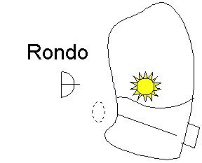
b) Rondo-5m-50m
Location:
Launch: Salen Moorings, Oban or Loch Aline.
Gas: loch Aline and Tobermory
Tides: Can be quite strong over the wreck, though nothing like the Hispania. The shell of the wreck offers protection from the current and it's good fun clinging onto the rudder post doing deco.
Description: Another classic wreck-no where else is there anything like it. The Rondo grounded on the rock and was salvaged heavily-the ship is just a shell. The rudder starts about 4m, and the bows are in 50m. Along the way there is an a-frame and some superstructure, as well as swimthroughs between the cliff and wreck at 25m and 35m. Heading down to about 41m, the wreck levels out and there's a bit of a swim along to the bows which are in roughly 48m. If you're looking for the magic 50.0m, try dipping into the f'ward chain locker area just before you get to the bow. There are often massive shoals of small fish hanging around this wreck, and the vis is usually excellent. Sometimes it's even very light down at 50m. To find the wreck, look at the picture below. The rudder is prominent on a sounder (i'd hope) but it is actually possible to swim under the rudder post and not even notice it...
c) Shuna-18m-35m
Location:
Launch: Oban or Loch Aline, Salen Moorings
Gas: loch Aline and Tobermory
Tides: pretty much none
Description: The Shuna was only found in 1990, but very promptly stripped of her non-ferrous items. The wreck is fairly gloomy and silty but still excellent, the prop and stern make a fantastic sight. Keep an eye out for the spare prop, and have a look around the engine room where small shoals of fish hang around under the walkways. If your finning isn't up to much, hang higher in the water so you don't destroy the vis for others. The bridge area makes for a silty swim through. The cargo of coal can still be found in the holds. There is usually a green or white can attached to mid-ships.
d) Thesis-16m-28m
Location:
Launch: Craignure, Oban or Loch Aline.
Gas: loch Aline. Tobermory is about 1 hour away
Description: Very strong currents exists here but with experienced divers and skipper, it is possible to drift on to the wreck and get inside it. The 'penetration' of this wreck is very very easy, with wide expanses and green windows everywhere. This makes for a very picturesque wreck, especially if you can swim away from the the bow on the outside. It's very nearly possible to cover the whole wreck this way and provides a welcome shelter from any current. Take this into account on the ascent though-the shotline may not be any fun! The wreck is covered in plumose anemones and deadmens fingers, and huge wrasse cruise around. Good vis is almost guaranteed.
d) Ballista: 5m
Location:
Launch: Craignure, Oban or Loch Aline.
Gas: loch Aline, mainland. Tobermory is about 1 hour away
Tides: None
Description: Considering the current-swept Thesis is a stones-throw away, the Ballista is extremely sheltered. She lies WSW of the Dartmouth (a protected site-no diving without permission) on top of 2 other wrecks. The story behind this situation, briefly, is that the first wreck grounded here and tried to lighten herself by shedding coal cargo. She sank. The next vessel came along to try and salvage the coal and sank. The ballista then arrived to do salvage work and then sank.
Below the water, a jumbled mess of 3 wrecks can be found in around 5m. Due to the depth, the site is very very kelpy and swelly but attracts a lot of light and life. There are nooks and crannies to be explored around the sections of superstructure that still exist and who knows what the storms could unearth here over time.
The nearby white can, halfway along the island is in fact a cannon from HMS Dartmouth and you should not use it as a mooring for your RIB!
e) Meldon: 0m-20m
Location: West side of loch Buie, SSE mull
Launch: Oban, mainland. Carsaig, Mull
Gas: Oban or take your own
Tides: non-existent round loch Buie.
Description: An excellent dive, worth the effort. The south of Mull seems to have bluer and colder water than the sound, but even so, the sand around this wreck gives an amazing amount of brightness. The wreck is home to lots of large fish and anemones. The rudder post is visible at low water and there was a small buoy straining to break the surface last time we were there. Take care not to run over the post with your boat!
The rudder and prop make an awesome sight, and it's worth wondering what went on in order for the wreck to be sat as she is-her stern pointing to shore and the rudder so far over that it has taken a chunk out of the propeller! The large prop shaft tunnel is visible for a considerable length down the wreck, follow this to the hold area, where you'll come across 2 huge boilers. The hold area onwards is pretty flattened except a small handful of very handy swim-throughs which exist between the side of the boat and the seabed. One is pretty small so take care. Random posts stand vertically around the hold area, and last time I was there, a large number of pollack were hanging around. I don't think we made it to the bow, which is marginally in better condition and the anchor is still present.